Backcountry Skiing
18 bowls of uncontrolled off-piste terrain — why Gulmarg is compared to heli-skiing
Critical Safety Information
All backcountry terrain at Gulmarg is uncontrolled. There is no avalanche mitigation, no ski patrol, and rescue must come from your own group.
- Always carry avalanche beacon, probe, and shovel
- Never ski alone — travel in groups and watch each other
- Hire a certified local guide who knows the terrain
- Check the daily avalanche forecast at gulmargavalanche.org
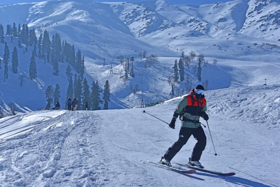
Gulmarg's backcountry has been compared to heli-skiing at a fraction of the cost. With the gondola providing access to 3,980m, you can explore 18 massive bowls, countless chutes, and over 2,500 vertical meters of terrain.
Backcountry Zones
The four main areas for out-of-bounds skiing from the gondola
Looker's Left (Southeast)
The easiest backcountry to access — just clip in from the top of the gondola and head southeast. Contains four main bowls: Sheenmai, Hapat Khued, Trajan, and Saffron.
Hiking Time
No hike required
Vertical
Up to 1,800m
Difficulty
Intermediate to Expert
Bowls & Features
Sheenmai Bowl
Easy access, North-facing 'Shaggy's Face', nice tree finish, easy return to gondola
Hapat Khued Bowl
Massive bowl with long white North face, multiple sub-ridges, ends in narrow gully
Trajan Bowl
Steep North aspect with technical terrain, beautiful pine tree shoulder at bottom
Saffron Bowl
Furthest bowl, requires early traverse to return without touring gear
Looker's Right (Northwest to North)
A vast area with over 10 bowls and gullies stretching from Army Ridge Bowl to Snow Leopard Face. Much terrain stays untracked for days after storms.
Hiking Time
20-30 minutes to summit
Vertical
Up to 2,000m
Difficulty
Advanced to Expert
Bowls & Features
Apharwat South & North Bowls
Accessed from 4,124m summit, alpine terrain with massive vertical
Chooti Nali Bowl
Walk over rocks from summit, good launching point for further exploration
The 4 Sisters
Excellent tree skiing, requires good fitness to reach
Snow Leopard Face
Premium gladed terrain, long hike but worth it
The Back (Southwest)
Walk up and over Mt. Apharwat Ridge to ski the back side. Features gentler rollovers near the summit and extreme terrain on Shark Fin and Great White peaks.
Hiking Time
25-45 minutes
Vertical
200-500m
Difficulty
Intermediate to Expert
Bowls & Features
Back of Apharwat
Gentle rollover, 200m to frozen lake, easy return to front side
Shark Fin
45-60 degree main chute, expert only, includes Pipeline and Mini Pipeline couloirs
Great White
Similar shape to Shark Fin but fewer cliffs, requires skinning back
Doggy Chutes
Two nice East-facing chutes dropping to frozen lake
The Far Far Side (Lienmarg)
The most remote terrain at Gulmarg. Hike the entire length of Apharwat Ridge or access via helicopter. Ends at the Army Base, requiring taxi back to Gulmarg.
Hiking Time
60+ minutes or heli access
Vertical
Up to 2,500m
Difficulty
Expert only
Bowls & Features
Multiple North-facing bowls
Full North aspect means dry, deep snow lasting for days
Alpine to forest transition
Upper third alpine, then mature Pine and Birch forest
Lienmarg area
Can end up 5+ km from Army Base, taxi required for return
Ski With a Local Guide
Local guides know the secret powder stashes, the safest routes, and how to avoid the frustrating run-outs that can take hours to escape. They also carry rescue equipment and have local contacts for emergencies.
Learn About Ski Guides